Sniffing out methane in the deep sea
Scientists cruise the Gulf of California’s Guaymas Basin to test out new tech for detecting and measuring methane in the deep
Estimated reading time: 4 minutes
In the deep ocean, far beyond the reach of the sun's rays, rising plumes of methane provide energy to fuel pockets of vibrant life. Bacteria, bivalves, tubeworms, and other creatures cluster together in unique ecosystems, thriving on methane and other chemicals. Methane is also a potent greenhouse gas and warrants measuring as we look to understand the impact of a changing climate on its release from ocean sediments. In Arctic locations, as the ocean warms, more methane from long-frozen sediments may be released and we need to understand if it can escape into the atmosphere.
To better understand deep-sea ecosystems and how our ocean is changing as the planet warms, researchers need reliable, cost-effective ways to track and measure existing and emerging sources of methane in the ocean. On a recent research cruise in the Gulf of California, the long, narrow strip of ocean between the Baja California Peninsula and mainland Mexico, scientists from Woods Hole Oceanographic Institution tested new instruments to find and detect methane and other gases in situ.
"We're developing this as a tool for exploration," says Anna Michel, chief scientist for WHOI's National Deep Submergence Facility and the expedition. "There are a lot of places where methane is being released in the seawater, but we don't necessarily know where they all are. Our goal is to be able to use these kinds of technologies to actually sniff out what's happening in these environments."
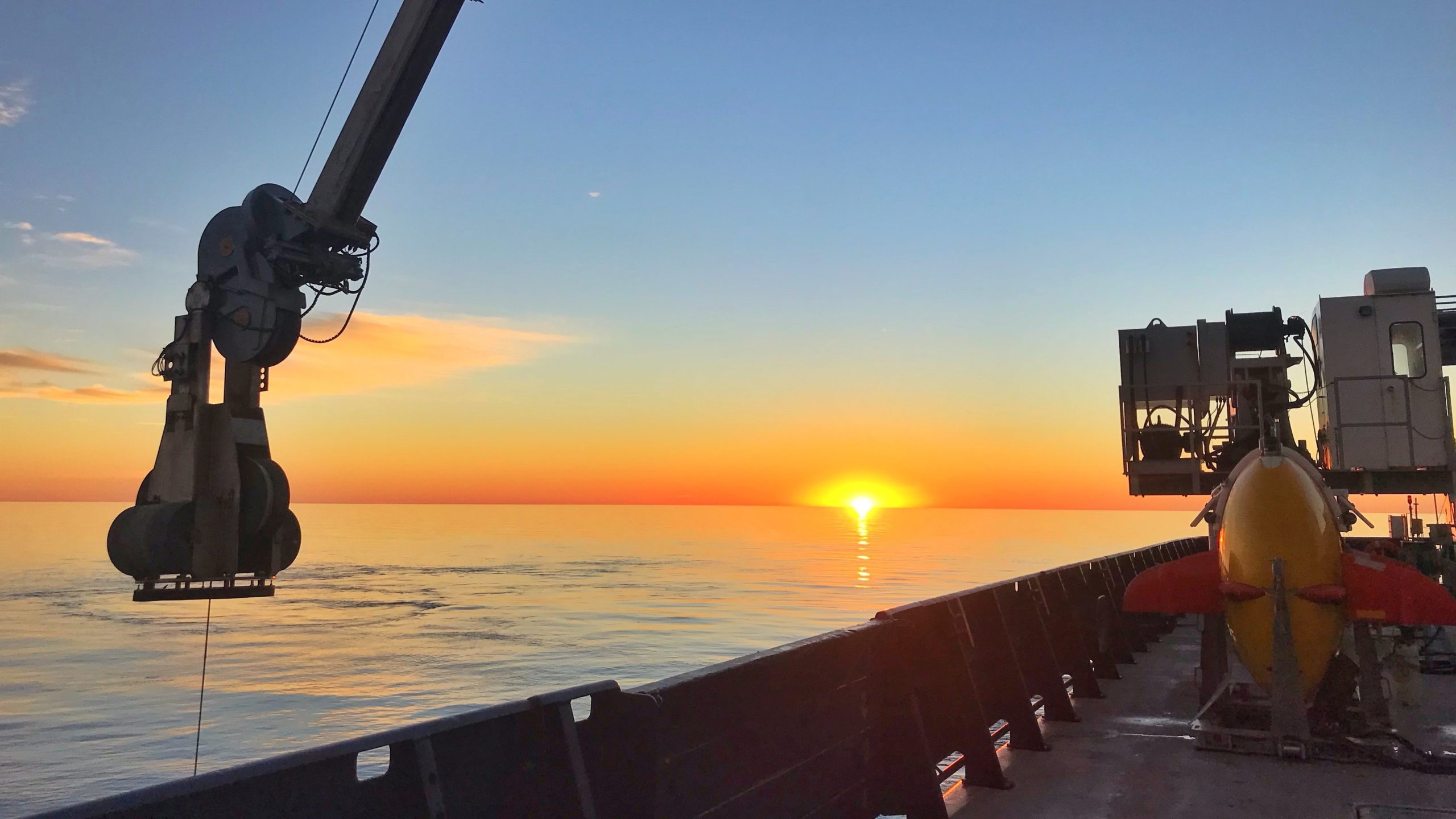
The researchers boarded the R/V Roger Revelle and headed to the Guaymas Basin, a region in the center of the Gulf of California with active hydrothermal vents and methane seeps. They deployed WHOI's AUV Sentry and ROV Jason, armed with new sensors, to explore the area.

The remotely-operated vehicle Jason is launched at the Guaymas Basin hydrothermal vent site. (Photo by Brooke Travis, Harvard University)
"This was a really good site to use as a testbed because we knew it had these high methane signatures," Michel says. "We were running dual vehicle operations, where we would dive with Jason on the site and examine what was there and then send Sentry out separately to chemically map the area and see the same signatures."
The instruments designed by Michel and her colleagues are gas sensors that can measure methane levels as the vehicles move through the water, using a technique called laser spectroscopy. The sensors, which can be mounted on either vehicle, pull dissolved gases out of the ocean and shine beams of infrared light through them. The light matches the specific wavelength that methane absorbs, so the amount of light that passes through the sample can be used to calculate how much methane is present. To keep costs down, many pieces of the sensors are adapted from off-the-shelf parts designed for telecommunications or other industries.
Hydrothermal plumes rise through the water like a column of smoke from a fire. If researchers are able to find methane signatures between 200 meters (656 feet) and 400 meters (3,281 feet deep) off the bottom with these new sensors, they may be able to infer some of what is happening on the seafloor.
Victoria Preston, a doctoral student in the MIT-WHOI Joint Program who was on the cruise, has developed software algorithms designed to model and predict methane plume locations and direct sampling robots to these areas accordingly.
"Plumes behave according to certain physical principles-they rise in a certain way and they spread out in a certain way-but there is a lot of uncertainty in terms of the source, the tides, and the content of the plume," Preston says. "I'm making these forecasts that say that the plume will be in this place at this time. If that's true, and this is the robot or the instrument I have to work with, how can I intersect that point and time in space so that I can get my measurement?"
During the expedition, Preston used data from Michel's methane sensors to inform her forecasts, allowing the researchers to design trajectories for Sentry to track a moving plume. At one point, as the vessel transited between two sites, the researchers detected methane plume signatures several kilometers away from areas with known hydrothermal activity. Michel, Preston, and their colleagues designed a new sampling plan to run a long transect with Sentry to see if they could determine where these traces were coming from.

WHOI research assistant Sarah Youngs and MIT-WHOI Joint Program student Beckett Colson at work in the wet lab on the R/V Roger Revelle. (Image courtesy of Anna Michel, © Woods Hole Oceanographic Institution)
"We think that the traces we saw kilometers away were possibly from a mix of the northern and southern basin hydrothermalism," Preston says. "As you get closer to these sites, you start seeing activity in the chemicals and other traces that indicate that it's newer, and then you're on top of the plume. So we think it's just a really, really large plume expression-unexpectedly large-but we don't know yet. There's still lot of data to process."
Both the new instruments and Preston's adaptive sampling algorithms worked well, and the scientists returned to Woods Hole with new research and engineering challenges to tackle. Michel is already planning the next improvements for the team's sensors to make them easier to deploy on other platforms.
"We'd really like to make these instruments smaller and lighter," Michel says. "And be able to push them deeper. We were working at around 2000 meters and we could work to 4000 meters right now. But for exploration, we'd like to be able to go to full ocean depth. We are very excited about how well we could detect methane and how we can use autonomous vehicles to facilitate this work in the future."
This research was funded by the National Science Foundation under the National Oceanographic Partnership Program. Co-principal investigators were WHOI associate scientist Scott Wankel and WHOI senior engineer Jason Kapit.